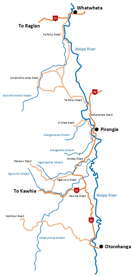
Waipa River
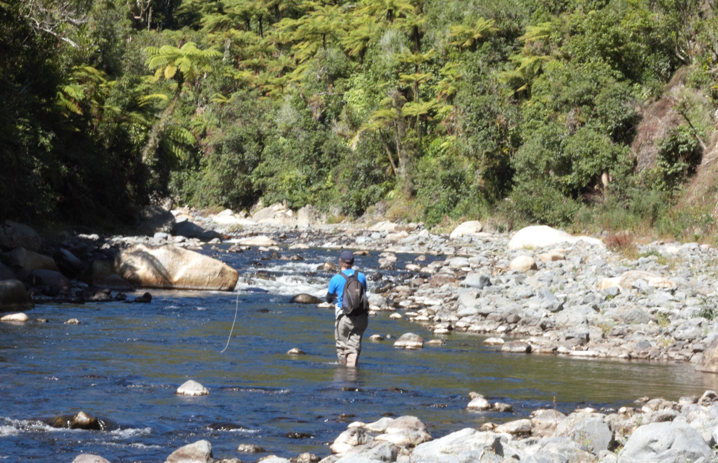
The Waipa is a large river that flows in a northerly direction from the Pureora Forest to the Waikato River at Ngaruawahia. Downstream from Otorohanga the Waipa is generally deep flowing and channelised but when flows are low there are rapids and shingle beds that can provide excellent spin and wet fly fishing. Good fishing can also be found at the mouths of small streams where trout often congregate in considerable numbers during summer.
Most angling occurs in the reach from Otorohanga upstream to Toa Bridge where the river flows across farmland and here there is superb water for anglers of all abilities. Long sections of riverbank have been planted in willows and these often shelter high numbers of trout. Wading is undemanding with shallow runs that allow anglers to cast beneath the overhanging willows or up into the deep pools. Access is via Rangiatea Road, Otewa Road, and Waipa River Road.
Walking upstream from Toa Bridge gives access to a 15 km stretch of backcountry fishing where the Waipa meanders through rough farmland and attractive patches of native forest. These waters can also be reached by crossing private farmland from Owawenga and Barber Roads, though this can involve a long steep walk. Further upstream, the river flows through a steep gorge with large boulders, rapids, and turbulent runs. This gorge can fish well but access is difficult.
Kaniwhaniwha Stream
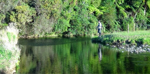
The Kaniwhaniwha is a delightful shingle and boulder stream that flows from the eastern slopes of Mt Pirongia through patches of bush and pastoral land to the Waipa River. It fishes well with dry flies especially in summer when algae can be a problem.
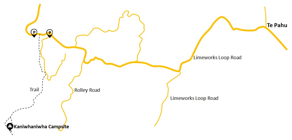
This stream is easily reached in 30 minutes from Hamilton or just over 90 minutes from Auckland using the Ngaruawahia – Whatawhata bypass. Most angling occurs in the middle reaches where the Kaniwhaniwha flows parallel to Limeworks Road. There is public access from Fillery Road downstream on the true left bank for 3 km; otherwise access is across private land.
Access to the upper reaches can be gained from a DoC track that runs alongside the stream from Limeworks Road into the Pirongia Forest Park. Here the Kaniwhaniwha is a small stream, nevertheless good fish can be found well upstream into the forest.
Ngakoaohia Stream
The Ngakoaohia is a large stream that flows from Mt Pirongia through long reaches of native forest, open farmland, and willow before joining the Waipa River. This stream provides excellent dry fly fishing especially during the summer months when cicada flies can be devastatingly effective.
Access to the Ngakoaohia can be obtained from the Pirongia-Ngutunui Road which runs parallel to the stream for about 10 km. There is no public access and landowner permission should be obtained.
Moakurarua Stream
The Moakurarua has its source in the steep hill country to the west of Otorohanga and flows in a northerly direction across farmland before joining the Waipa River near Te Awamutu. The lower reaches are not attractive to anglers as they are sluggish and deep; however in the middle and upper reaches the Moakurarua has a clear gravel bottom, mostly wadeable, offering good fishing waters. The middle reaches are accessible from the Otorohanga-Kawhia Road. Although the river is lined with willows, these are not so thick to stop spin fishing and indeed provide cover for a good trout population.
The upper reaches are accessible from the Otorohanga-Honokiwi Road some 15 km from Otorohanga. Access to the river can also be gained from Tapuae Road across private land. This is a highly regarded fly fishing stream with an excellent trout population and attractive waters.
Select image for larger view