Information on access from Waimiha stream to the Taringamotu River which is between Te Kuiti and Taumarunui.
To view the access map and brochure click on Upper Whanganui Headwaters.
Select link to go directly to river/stream information:
Waimiha Stream
Ongarue River
Maramataha River
Waione Stream
Taringamotu River
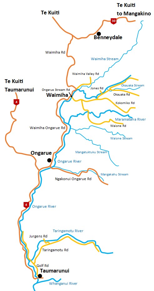
Map of upper Whanganui Headwaters
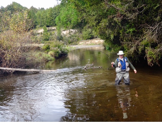
Waimiha Stream
Stream is covered in blackberries making access difficult bring secateurs.
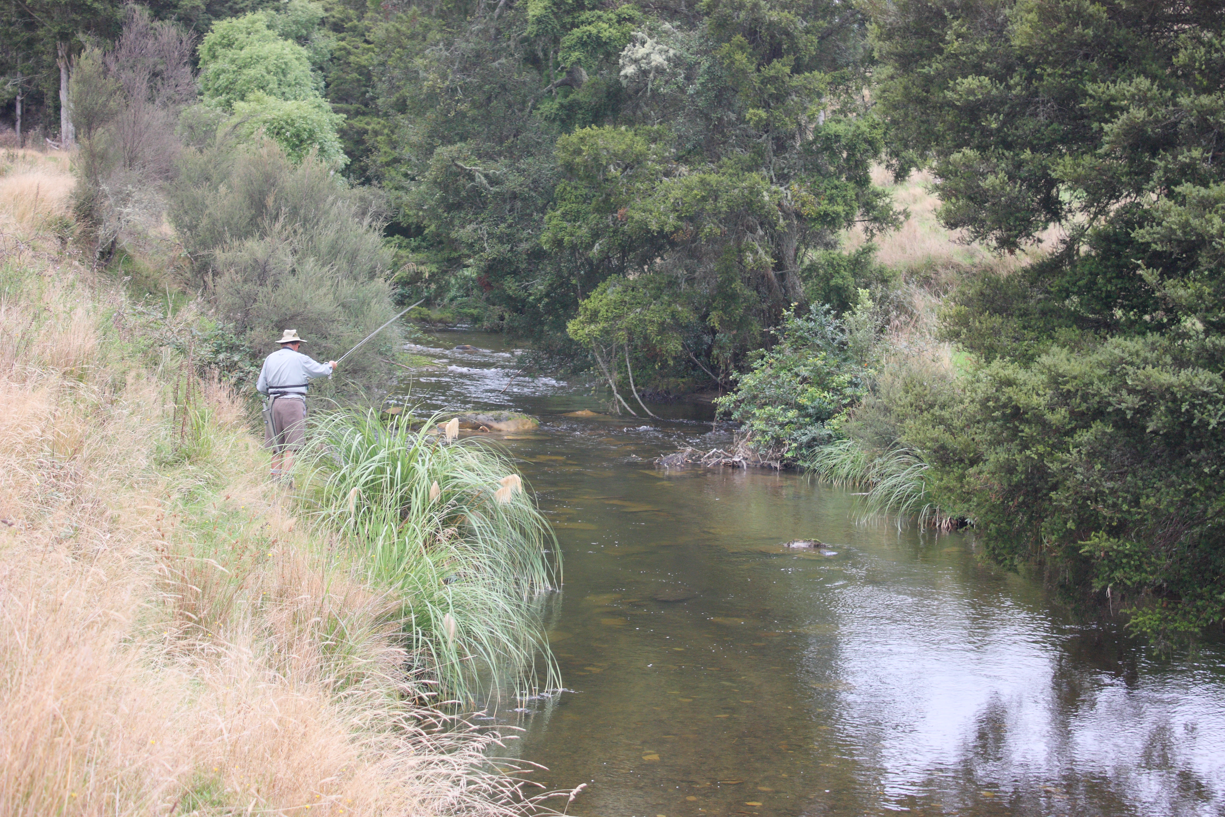
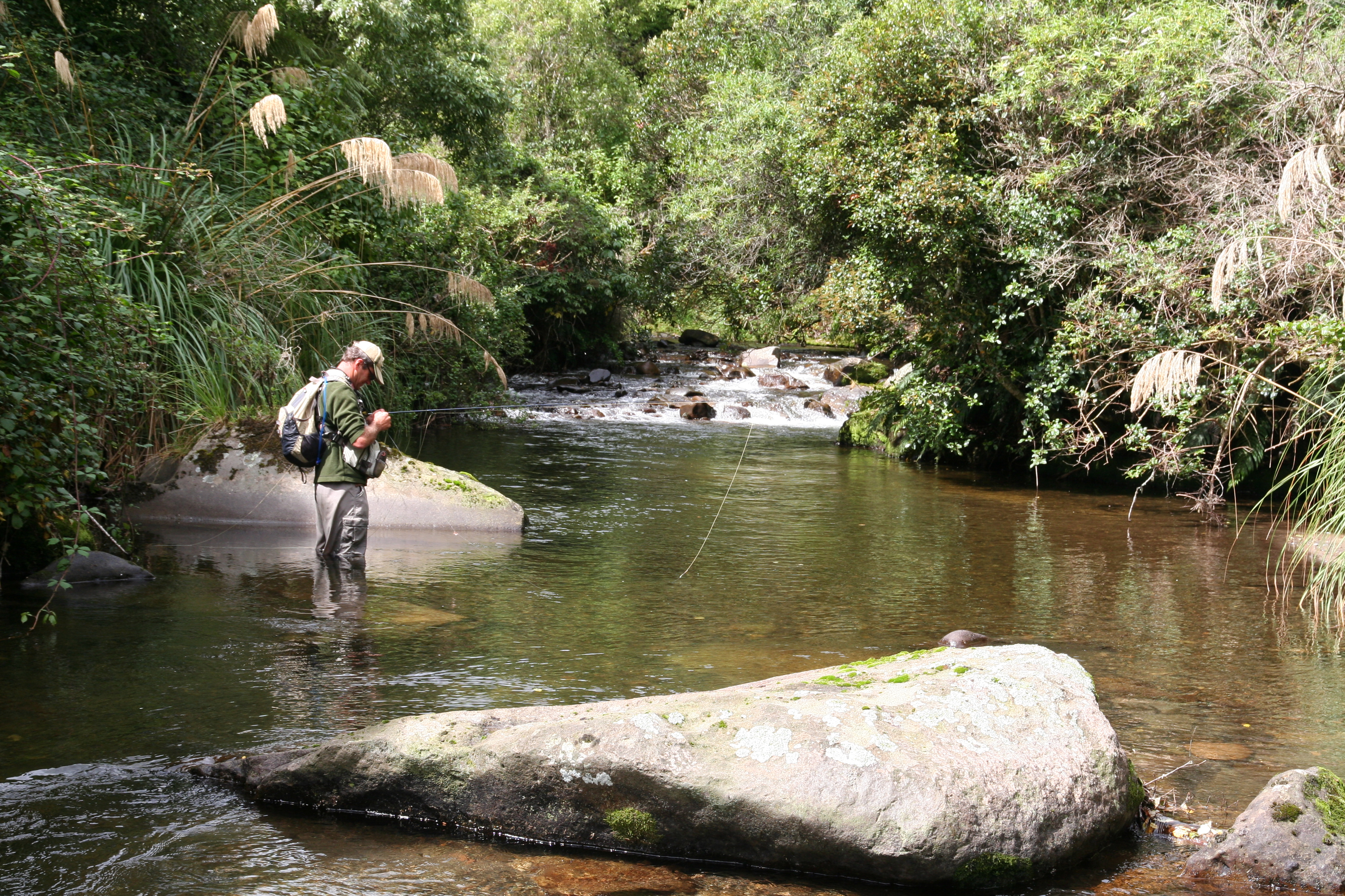
A delightful stream holding large numbers of rainbows and the occasional big brown. The lower reaches offer clear, low banks providing relatively easy fishing - a perfect place for the beginner. Further upstream, the Waimiha flows through scrub and native forest providing attractive fishing waters. Some good fish are taken from this section.
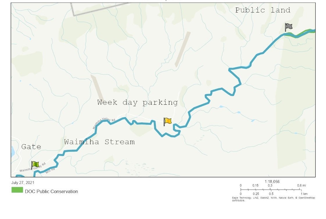
Fish and Game have negotiated access across the Whenuatupu-Ohinemoa Trust farm that will allow anglers access to the public land upriver of the farm. Access through the Whenuatupu-Ohinemoa Trust farm will be granted under the following conditions:
- Anglers must check in with farm manager 027 275 9644 when intending to enter the property.
- Driving beyond the first gate is only permitted Monday-Friday 8am-5pm.
- If anglers wish to cross the property outside of open hours, they must park outside the first gate.
- No dogs allowed on the trust farm and no gates are to be obstructed.
- Anglers crossing trust property must stay on the farm track and follow the orange trail makers to the river entry point (4 Km).
- Land between the track and river is private until anglers reach the marked entry point.
- Anglers will park at their own risk as the area is a working farm.
- Gates are to be left as they are found.
The parking areas will be marked with Fish & Game signs and the track to the access point will be marked with orange DOC style triangle markers. During the weekday open hours, the walk into the public land will be approximately 2.6 km but the access outside of open hours will be just over 5km. Although this is quite a walk the track is easy, and it is an ideal spot to use a mountain bike or electric bike.
In the upper reaches the Waimiha is a small stream that meanders across farmland with stable pools and runs. The streambed consists primarily of papa rock, and in common with other papa bed rivers holds an abundance of fish. This section is highly regarded for its dry fishing for big brown trout and smaller but more abundant rainbows. The upper reaches run parallel to State Highway 30 (Te Kuiti - Mangakino) east of Benneydale, with access across private farmland.
Ongarue River
Despite its relative remoteness the Ongarue is a popular river offering a good catch rate of large rainbow trout as well as many kilometres of fishing water.
The lower reaches below the confluence with the Waimiha are rarely fished, somewhat surprising as this section offers some very good spin fishing waters especially in the gorge downstream from the Waimiha Township. Access is from the Waimiha-Ongarue Road which runs parallel to the river.
Access to the middle reaches can be gained across farmland from the Ongarue Stream Road, which runs parallel to the river (landowners permission required). The first public access via an unformed paper road is about 1.6 km past Kokomiko Road. Here there is attractive water as the river meanders across pastoral land with good deep pools, wadable shingle runs and lots of fish. Further upstream the Ongarue flows through extensive bush areas and short stretches of farmland offering superb water for nymph and summer cicada fishing. From the road, this looks a rugged impassable river but experienced backcountry anglers should have little difficulty and will often be rewarded with a high catch rate.
An upper tributary, the Okauaka Stream, also offers excellent fishing. Although from the bridge the Okauaka looks a rugged impassable stream, it does hold much attractive water a short distance upstream and is easily wadable. The Blackfern lodge is a great place to stay when fishing the Ongarue River with ample public access to some great fishing water at the lodge. The owners do require guest to release trout.
An esplanade reserve provides ample public access on both sides of the Ongarue River, including the Okauaka Stream, but there is private land along the river so please check the Walking Access Commission on their website (www.wams.org.nz). Printing an access map of the area is recommended.
Maramataha River
The Maramataha is a large backcountry river that receives little fishing pressure due to difficulties of access compared to the nearby Ongarue. Nevertheless the Maramataha offers a different fishing experience from other southern rivers and is well worth the effort.
From its confluence with the Ongarue River the Maramataha meanders for about 5 kilometres across farmland providing pleasant fishing on browns and rainbows averaging about 1.2kg. This is an easy section to fish, mostly wadable with clear banks. Access is gained by crossing private farmland from Waione Road.
Upstream from Waione Road the Maramataha River becomes much more rugged, flowing through a bush clad gorge. This section holds a low population of large rainbow trout, averaging 2-3kg, in generally very clear water. Access to the Maramataha can be gained across farmland from Kokomiko Road or through the Pureora Forest from Maramataha Road (4-wheel drive required). A long, steep walk requires a reasonable level of fitness.
Waione Stream
A large stream that flows across farmland and through patches of bush with a good population of rainbows, averaging about 1 kg. Public access is limited to the mouth (not easily accessible) and the forest park. The Pureora Forest has typical backcountry fishing with a low population of large rainbows. Access from Waione Road is by permission only.
Taringamotu River
A small river that joins the Ongarue River at Taumarunui, and provides about 10 kilometres of fishing across pastoral land. Rainbow trout averaging about a 1kg are common. There is public access near the confluence from the Ongarue Back Road and Downstream of Jurgen Road.
Please select image for larger view.