Please select here to view full map
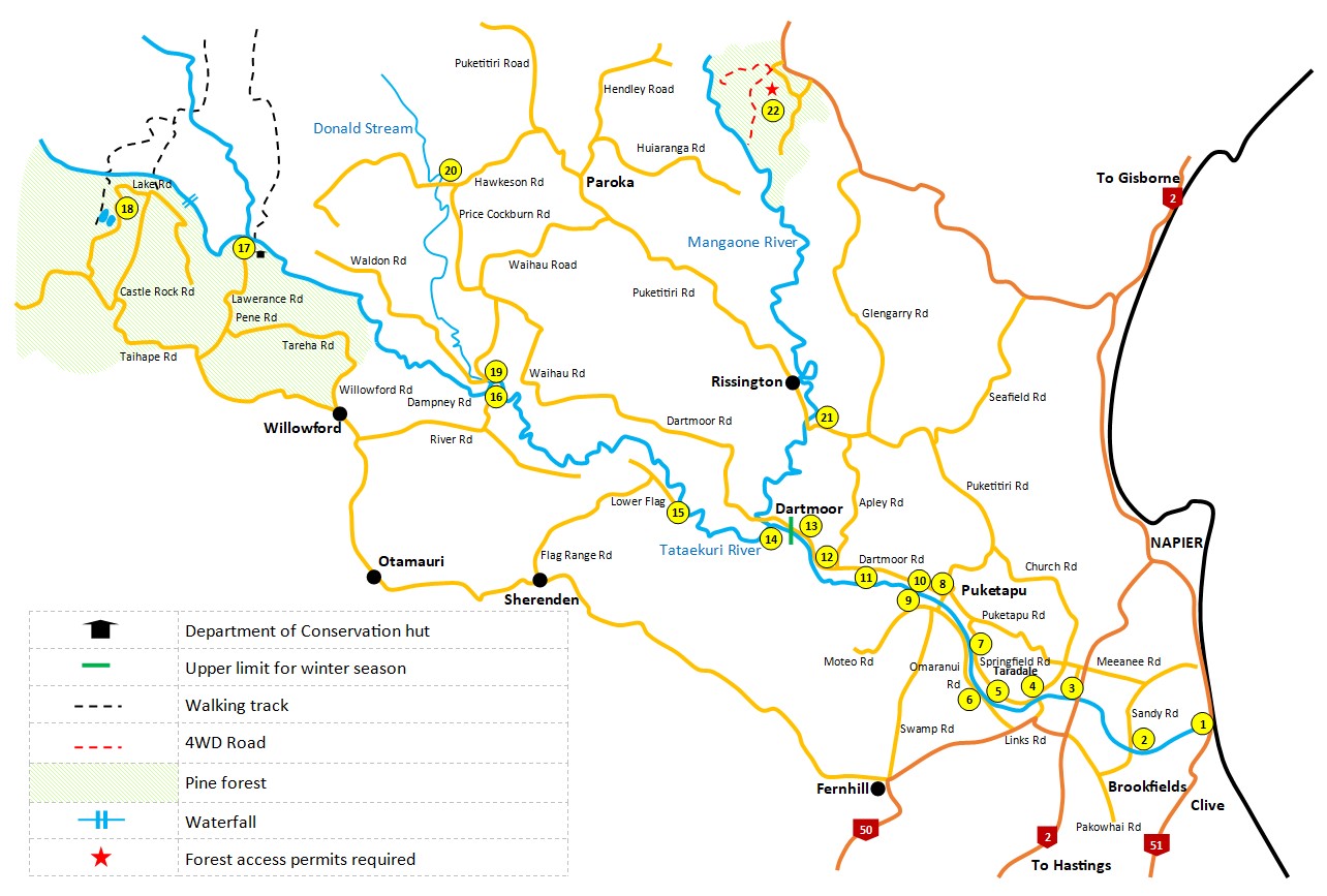
1 to 14 - Excellent public access provided by the Hawke's Bay Regional Council featuring parking, picnic areas and most with vehicle access. No 14 also gives access to the Mangaone River.
15 - Lower Flag Range Road provides public vehicle access to the river. The road is gravel and 2wd is not recommended on the final part when wet.
16 - Dampney Road provides public vehicle access to the Tutaekuri River and Mangatutu stream. The road is gravel and 2wd is not recommended on the final part when wet and the ford is only safe in normal flows.
17 - The route through the forest to the Lawrence Hut area is marked by the Department of Conservation.
Kuripapango Lakes Access Points
18 - A short walk off Kuripapango Road takes you to the Lakes.
Mangaruru Stream Access Points
19 - Waldon Road takes you to the Tutaekuri River and Mangatutu Stream. Park off the road by the Mangatutu Bridge to access the lower section of this stream.
20 - Park off the road by the Hawkeston Road Bridge to access the stream. Access is provided by Hawkeston Station so respect this by staying along stream margins and please no dogs or rubbish.
Mangaone River Access Points
21 - Park under the bridge on Puketitiri Road over the Mangaone River.
22 - Access through Matariki Forests by permit only.
Select map to view larger